Per survey, property is indicated to be
approximately 174,646 square feet, 4.009 Acres,
including submerged land area located east of east
Intracoastal Waterway right of way line.
Gross Acreage:
4.475 Acres (including portion of Riverside Drive
R.O.W. for site planning purposes)
Net / Total Site
Acreage: 4.009 Acres
Upland: 2.2 Acres
+/- (100,000 sf +/-)
Water / Marina:
1.8 Acres +/-
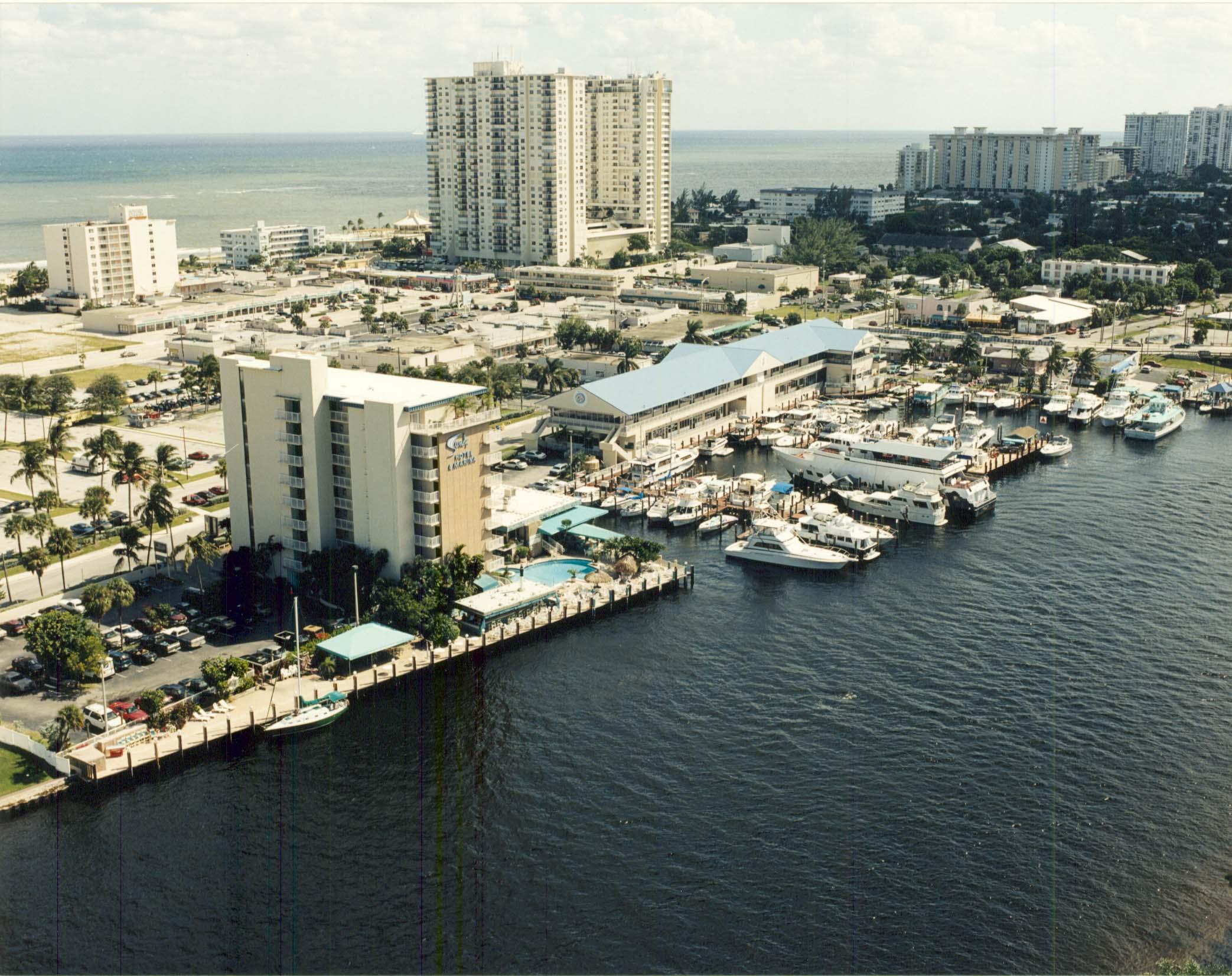
Office
Building: 2-story, 28,000
square feet built 1989. First floor enclosed 1998.
Poured in place steel reinforced concrete.
TOP OF
PAGE
Marina: The marina consists
of 50 numbered slips situated primarily over fee
simple titled land owned by owners. Estimated lineal
dock feet = 1,372 feet. Clear space between docks
allows berthing of vessels longer than stated dock
lengths.
Western end of
"T" docks and north property end bulkhead docks
situated over submerged state lands previously
subjected to submerged land lease (see "Submerged
Lands" below). Location of docks into ICW
"grandfathered". If docks were built new today, end of
docks may not be allowed to extend into state lands
due to conflict between rights enjoyed by privately
owned docks versus docks situated on state submerged
lands. Fiberglass fuels tanks.
"Estimate" of potential vessel
parking length =
3,000
feet (50 vessels x
60 foot average). General breakdown of existing docks
as follows.<
North End Of
Site:
Within Basin:
- Three 20' docks (allowing double sided docking on each)
- Two 41' docks
(allowing double sided docking on each)
- Twelve 40' docks (allowing double side docking on each)
- 200' (estimated) docks along eastern basin bulkhead
- 120'(estimated) docks along northern basin bulkhead
Endcaps:
- One 56' dock ,
endcap, south end of site, double sided docking
- 100'
(estimated) double sided docking, center end cap T
dock
- Trident north
end cap, 46' +/- docks, all double sided docking